
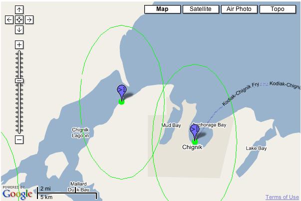
Two error circles representing point certainty are displayed on the first map in geographic space. This rendering is from my first implementation of BerkeleyMapper which used geographic space for all maps.
The second map displays these same error radii in the second implementation of BerkeleyMapper which leverages GoogleMaps API. Google uses a Mercator projection, which preserves local shape but has a large degree of exaggeration towards the poles. Both of these samples are technically correct I suppose but I'm not so happy with the vertically exaggerated ellipse from the GoogleMaps API example.
The vertical exaggeration of the ellipse in the second sample, however, is preferable to the "squishing" affect of geographic space, particularly when underlaying USGS topos (as the map text will appear flattened in northern and southern latitudes).
No comments:
Post a Comment